In this article I'd like to introduce you to the VE2DBE service for analysing repeater RF coverage. It helps you choose a QTH for a new repeater and evaluate an existing one. Thanks to UZ5DU and UZ5DX for introducing me to it — now it's my turn to introduce it to you.
Signing up
Go to and sign up. The password arrives by e-mail; you can change it later, since the generated one is impossible to remember.
Let's assume you have signed up, received the password and logged in. Open your account. Here is a quick look at what the service does and how the site menu is organised.
What it does
1. Repeater RF coverage analysis from the entered coordinates, taking into account terrain, antenna height and characteristics, radio propagation at the given frequency and more.
2. Radio line-of-sight analysis between two QTHs.
3. RF coverage of an area served by one or more repeaters.
The service menu
For convenience, the site menus are grouped by colour. Let's go through each of them:
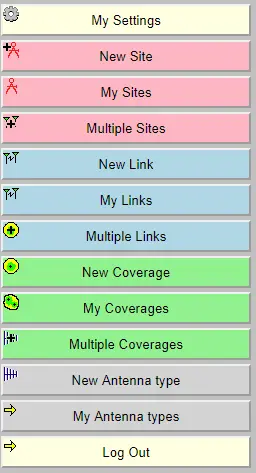
My settings: your personal settings. Everything here is self-explanatory: change the password and choose the default map — in Map background source select OpenStreetMap - Road.
My antenna types: the antenna catalogue. It already has 4 predefined types: Omni, Ellipse, Cardio, Yagi.
New antenna types: add your own antenna types.
New Site: enter a new QTH.
My site: your QTHs, with editing.
Multiple Sites: your QTHs on the map.
New Link: analyse the RF path between two points entered earlier in My site.
My Links: saved RF path analyses.
Multiple Links: analysed paths on the map.
New Coverage: enter data to plot a repeater's RF coverage on the map.
My Coverages: saved coverages.
Multiple Coverages: the coverage of an area by one or more repeaters.
Plotting the coverage
The site is simple and intuitive. Let's plot the coverage area of a single repeater:
Create the repeater's QTH: open New Site and drag the marker to the repeater's location on the map. Press Submit to apply.
Edit the repeater's QTH: open My Site, select the new entry and press Modify. Fix the name and enter the ground elevation above sea level in the Elevation field.
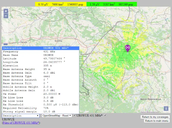
Create the coverage map: press New Coverage and enter the location, antenna type, height above ground and direction, frequency, power and so on. When done, press Submit to build the model.
The result looks like this:
Several repeaters
If you enter and save several repeaters, you can pick all or some of them in Multiple Coverages to show them together. Hold Ctrl or Shift to select several.